More people are accessing dynamic place-based information at the touch of their fingertips through INTERACTIVE ONLINE MAPS—whether via smart phone, computer, or other device.
Communities across the Midwest are now integrating these online features into their web-based platforms to provide residents, visitors, businesses, and developers with the most up-to-date and accessible information.
What is an interactive map, and what can it do?
Interactive maps can “tell a story” by displaying multiple layers of information. They engage users by exploring complex concepts through partly or wholly self-guided means (interactive), and can display as well as collect data in a dynamic and intriguing way.
Types of interactive mapping data can include:
- Display of land uses and zoning districts, municipal codes, and ordinances
- Showing key development site opportunities
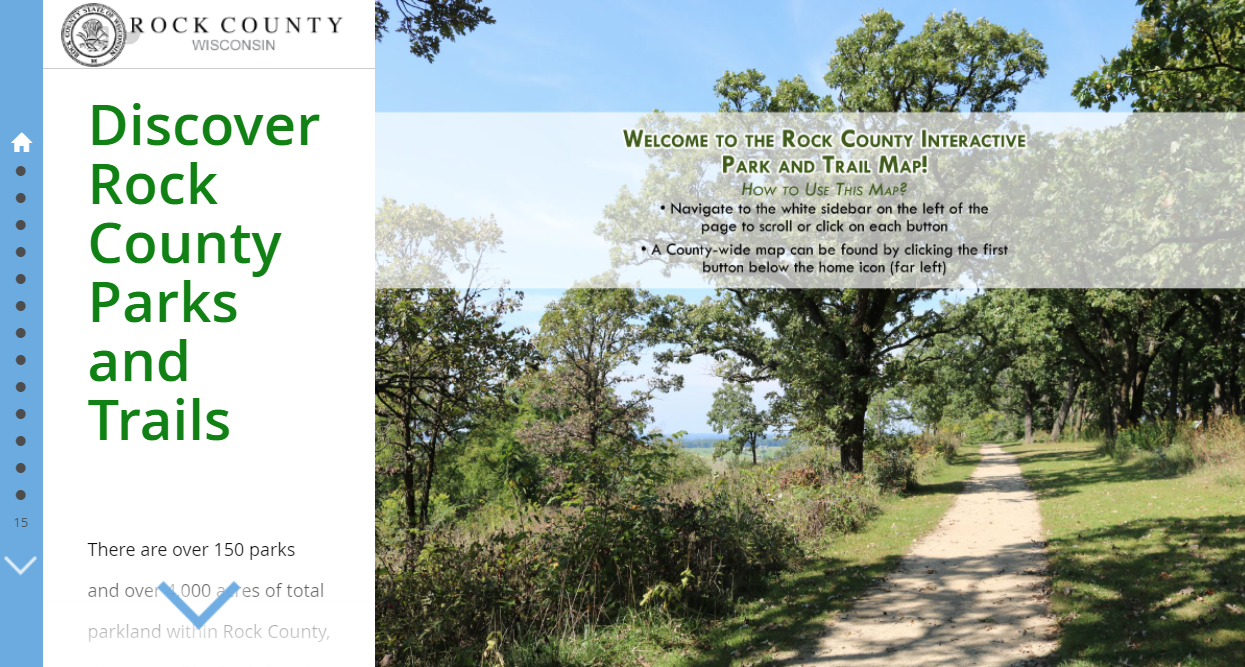
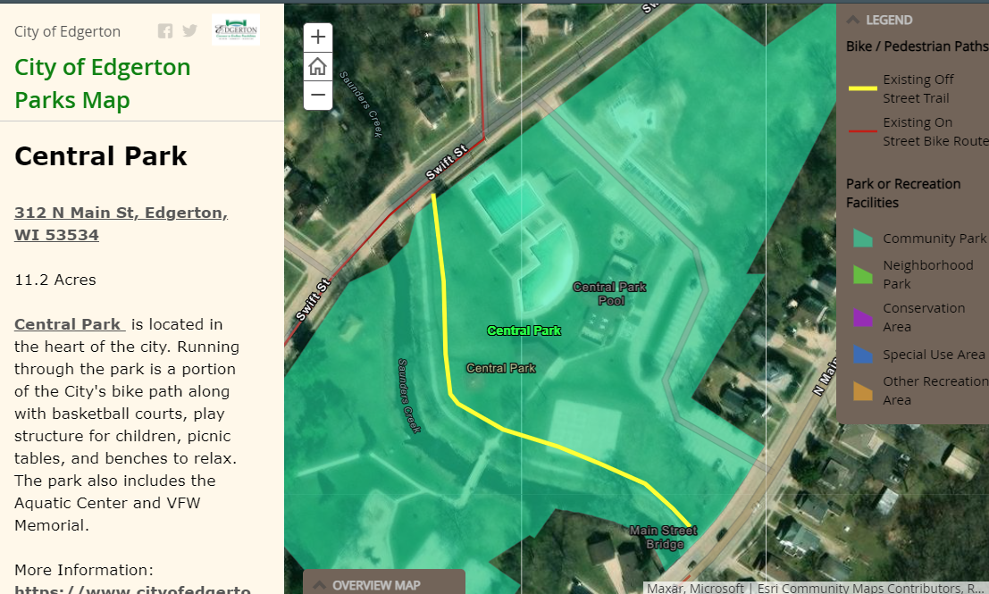
- Defining existing and proposed parks and trails systems – such as this Edgerton Park and Trail Map
- Displaying geographic features such as vegetation cover, slopes, rivers, watersheds
- Showing activity hot spots such as bike trail use
- Collecting and/or displaying public participation comments
- Telling more information, background or history about a place through text
- Providing additional views, ground photos, or future vision graphics
This rapidly-evolving technology has been utilized to generate hundreds of public responses to various planning projects. It can also provide long-term, user-friendly platforms for daily use by community staff, officials, and the public.
Types of projects that benefit from interactive maps:
V&A offers three primary kinds of web-based maps:
- STORY MAP—can, as the name implies, tell a big story or act as a project home page for a big project like this one for the Beloit Comprehensive Plan.
- CROWD-SOURCED/PUBLIC INPUT MAPS—Crowd-sourced/Public Input maps include the many maps we’ve made for Comp Plans, Park Plans, and others where the public can map ideas or issues for future improvements themselves. Examples include this Public Input Tool: Hancock County Comprehensive Plan. We have also created similar public input tools for the Shorewood Hills Corridor Plan, Bayside Comprehensive Plan, and Manitowoc Comprehensive Plans.
- STANDALONE MAP—a single interactive communication tool that performs generally one specific function. Examples include this standalone Zoning map we developed for the City of Fort Atkinson.
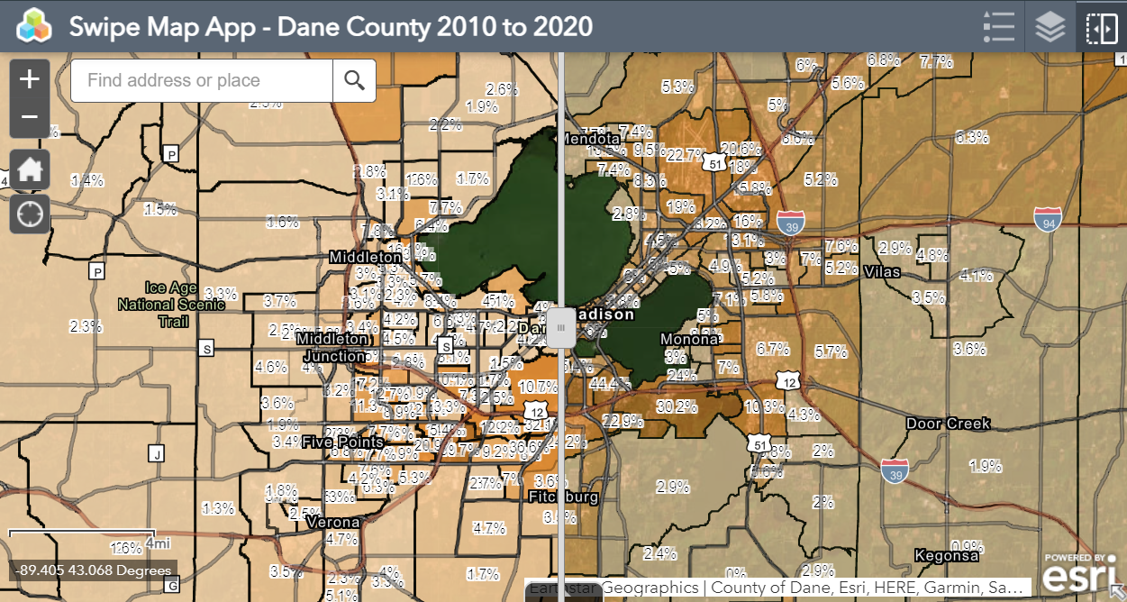
A “Swipe Map” could be incorporated into a Storymap or stand alone. This visual tool lets you drag a slider bar back and forth to compare two overlaid images of an area at two different periods of time “Before and after”.
Our integrated approach is a map for success.
Why work with V&A on your next interactive map? The benefits are many, and come in three big categories:
- COMMUNICATION: Clearly communicate challenging, complex, or abstract topics, including:
- Visualizing abstract ideas on the land.
- Displaying multiple levels of information, allowing a story to unfold in the most clear and compelling way for each individual user.
- Fostering a targeted and efficient two-way communication process with a definable result.
- REACH: Reach a greater number and more diverse selection of people where they are.
- Interactive maps can reach more people who don’t have time or are physically or geographically unable to come to a scheduled in-person meeting. The result? More responses from a wider audience.
- VALUE: Build in cost effectiveness, high value to-effort, and success.
- V&A creates these exciting tools cost effectively as part of the Planning process (although we are happy to do them as a stand-alone communication project). In this way V&A’s interactive mapping makes the Planning process itself that much more successful at gathering valuable information, and at building clear project understanding.

ArcGIS Storymaps: What we use. We employ ArcGIS online platforms to build, store, display, and update a wide range of interactive map information for communities across the Midwest—typically hosted on each community’s website.
Let’s talk about going interactive!
Ask us about incorporating an interactive map into your next Comprehensive, Park Plan, or other public process need. Or talk to us about the newest mapping capabilities. Discover for yourself how the two-way communication opportunities of interactive mapping are of the most enticing and effective technological tools now available to build project success.